More Satellite Data
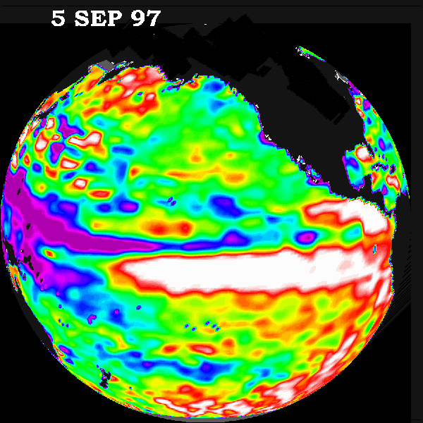
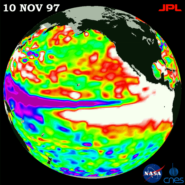
Figure 1: The above satellite photographs show the height of the ocean above or below normal on the given dates. White & red represent above normal while blue and purple represent below normal.
CONTINUE ANSWERING THESE QUESTIONS ON YOUR SEPARATE SHEET OF PAPER:
Compare this data to the April-June 1997 data. What trend do you notice developing along the equator from April to November? What’s happening to the Western Pacific Ocean along the equator?
Draw a circle representing the globe. Then sketch in the normal global wind patterns. Be sure to label your high and low pressure zones. In which direction do winds normally circulate along the equator?
On your illustration (from question 4) roughly outline the location of the water that is above the normal sea height. Then do the same for the water that is below the normal sea height. Label it.
Using the November satellite data, describe what the ocean temperature would be like in the Eastern and Western Equatorial Pacific (higher or lower than normal).
What would happen to the air temperature and pressure above each part of the ocean, as a result of this? (higher or lower than normal) EXPLAIN.
With these changes from normal conditions in the ocean water, what change will occur in the global equatorial winds? (Remember: How do winds circulate?)
With this change in the direction of the wind, how will the ocean circulation be affected along the Equatorial Pacific?
If a large mass of air moves very slowly over the Eastern Equatorial Pacific during November 1997, what characteristics will it take on? How might this differ from a year with normal ocean conditions?